

What Airport Drone Detection Systems Do, and How Security Teams Respond
Airports and aviation facilities employ drone detection systems which typically combine RF sensing, radar, and electro-optical or infrared confirmation, to identify unauthorized drone activity near runways and approach paths. Detection alone doesn’t stop a drone, but it does give air traffic and security teams the information required to decide whether to delay operations, alert authorities, or initiate an approved mitigation response.
Drone sightings near airports are no longer isolated incidents. The volume of drone sightings at airports are increasing year on year. The FAA alone receives more than 100 reports of drone sightings near airports every month, with airports around the globe certainly not immune.
Each incident initiates a chain of events and decisions that can ground aircraft, divert flights, cause delays, and result in thousands of passenger trips being affected. In more drastic circumstances, public safety can be compromised.
The question isn’t whether drone detection airports require a dedicated counter-drone solution. The question is what kind of detection architecture is required to make that subsequent decision sequence faster, more accurate, and more defensible.
Why Are Drone Sightings a Growing Problem for Airports?
In October 2025, Munich Airport suspended flight operations for several hours after drones were sighted in the approach corridor, affecting thousands of passengers across dozens of departures and arrivals. Two weeks earlier in the Netherlands, Eindhoven Airport faced a similar drone-related flight suspension. In more dire circumstances during 2026, both Kuwait and Dubai international airports suffered a series of hostile drone strikes, linked to regional conflict.
Amid the spectrum of outcomes and intentions, a fact remains that drone incidents, which are becoming more frequent, impose elevated personal safety concerns, and significant operational and economic costs.
Airports have long dealt with disruptive and hazardous low altitude events such as birdstrike and adverse weather conditions, but the rise of drone sightings poses a different set of issues. A bird can be visually confirmed, and its trajectory assessed in seconds. Weather can be predicted. However, an unconfirmed and unexpected drone sighting that hasn’t been confirmed via counter-drone architecture is simply a report with all the vagaries of an eye-witness account, replete with estimations of time and character, not a verified threat picture.
When a suspected UAS is reported, air traffic control has little choice but to treat an unverified sighting seriously, which means halting or delaying operations until the airspace is declared clear. The frequency of these incursions and reported events is increasing, in no small part due to the availability of commercial drones leading to a greater number of platforms and pilots that can (and do) reach airport-controlled airspace.
While no-fly zones, altitude limits, and regional laws provide regulatory deterrents, they’ve proven insufficient to prevent many incursions, whether accidental or deliberate. Airport drone security system architecture built around comprehensive UAS detection addresses these instances by confirming a drone’s presence, location, controller’s location, and behavior. Ideally all in a timeframe that allows precise decision-making and appropriate action.
What Makes Airport Drone Detection Different from Other Sectors?
Airport perimeters present a detection challenge that differs from many other critical infrastructure categories. In DroneShield’s recent Global Assessment of Counter-UAS Readiness Across Airports and Critical Infrastructure, it was found that aviation environments carry the highest consequence exposure to unauthorized drone activity. The survey also found that 60% face regulatory and legal restraints and 70% experienced detection capability gaps.
The airspace around a major airport extends several kilometers from the runway and covers multiple flight corridors simultaneously. Counter-UAS detection infrastructure has to match that broad coverage requirement while operating reliably in an environment that generates significant RF background noise from navigation systems, communications equipment, ground vehicles, and passenger devices. The detection solution itself must not introduce signal interference to aviation operations.
The general physical environment adds further complexity with large airport footprints typically including open terrain near runways with accompanying terminal and ground transport zones. Radar performance varies significantly between these environments, with low-altitude drones over open ground presenting a different profile from one flying through a cluster of terminal buildings. EO/IR sensors also face geometry constraints in this same terrain. An RF detection layer that monitors the spectrum continuously regardless of terrain provides the baseline coverage that other sensor types can then supplement with additional data and multi-sensor drone confirmation.
Another significant difference with airport airspace security is the strict regulatory constraints that don't apply to other sectors, namely the authority to act. Upon drone detection, airport security teams face severe constraints in terms of response options, as compared to a military installation, corrections facility, law enforcement domain, or government site. Oftentimes, direct action such as RF Jamming or kinetic defeat, is dependent on external parties that are authorized to act. This means that drone detection in the aviation sector needs to lead to a detailed information hand off to the relevant authorities, requiring solid C-UAS data acquired through counter-drone architecture.
What Does Airport Drone Detection Actually Reveal?
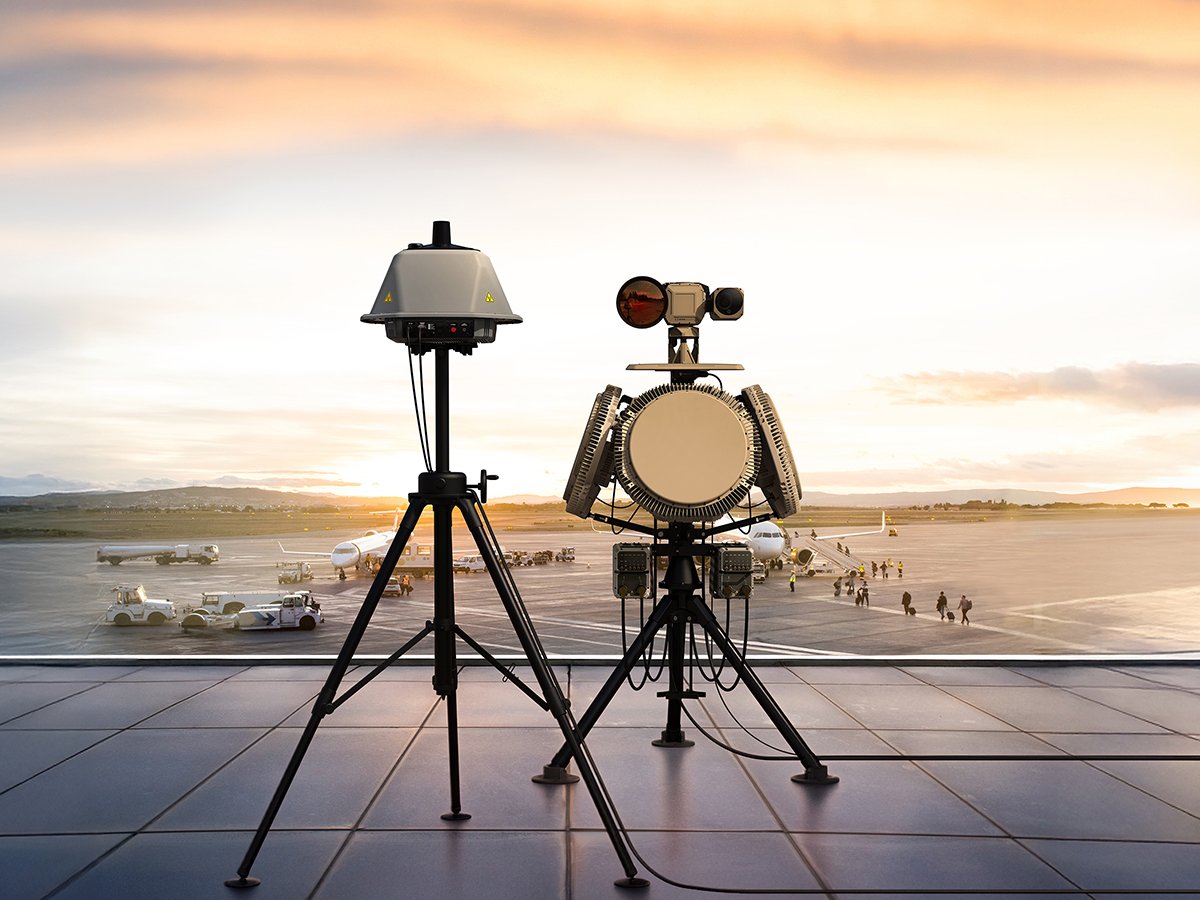
Airport drone detection technology generates four primary categories of actionable intelligence, each of which informs different aspects of security response.
The limitations of individual sensors and how they complement each other in a CUAS stack need to be understood in terms of deducing a drone’s presence, location, trajectory, and classification.
In layered sensor architecture, it’s important to note that RF drone detection airport systems are the only sensor type that produces both drone classification and operator location simultaneously. While radar can confirm physical presence and provides excellent trajectory and do-on-map data, it draws no signal intelligence. EO/IR provides visual confirmation and can assist classification but depends on being cued toward a known bearing before it can resolve a small target at operational range. The complete picture requires all three layers working together.
What Do Airport Security Teams Do with Drone Detection Information?
The detection-to-decision sequence at an airport operates under time and regulatory pressures that many other C-UAS deployments don't face. A drone on an intercept heading with a flight path can cover that distance in minutes, if not seconds. The value of a detection system is measured in how quickly and confidently it can give a security team the information needed to initiate the correct response.
The typical response, in most airport environments, follows an escalation path:
Detection triggers an alert.
The security team assesses location and trajectory against current traffic.
If the drone is inside controlled airspace or on a heading that poses a runway incursion risk, air traffic control is notified, and a hold or ground stop decision is made.
Authorities are alerted.
The detection data, including drone position, heading, speed, operator location, is passed to local law enforcement to inform the response.
What detection doesn't do, in most civilian aviation contexts, is authorize the security team to act against the drone directly through kinetic means or RF jamming.
What Are the Legal Limits on Drone Response at Airports?
Regulations around the globe will differ depending on the country and/or state jurisdiction. Individual jurisdictions require direct consultation, but there remain many similarities.
In the US, EU, and Australia, unauthorized drone operations near airports are prohibited and airports are required to report sightings to their relevant civil aviation authority. The FAA governs this in the US including FAA drone reporting requirements for airports, national authorities under the EASA framework in Europe, and CASA in Australia.
In terms of the legalities behind mitigation authority, in all three, active countermeasures including RF jamming, GPS spoofing, and kinetic defeat are restricted to authorized government agencies. Commercial airport operators are generally limited to detection, classification, and handoff to those authorized parties.
The practical result is that airport drone security architecture is built around generating the best possible detection data and escalating it swiftly and thoroughly to the authorized parties who can act on it.
What Does Layered Drone Detection Look Like at an Airport?
Modern layered counter-UAS security in airports combines passive ultra-wide band RF sensing as a continuous baseline layer with radar for physical tracking and EO/IR for visual confirmation, all stitched together via sensor fusion software. The RF layer monitors the spectrum around the airport perimeter without emitting, which means it contributes no signal for a drone operator to detect or avoid. When an RF event is confirmed, radar cues to the bearing and establishes a physical track. EO/IR then provides close-range visual confirmation that supports classification. The subsequent decision sequence can then be firmly activated. DroneShield’s airport deployments are built on this layered architecture, with SensorFusionAI integrating RF, radar, and EO/IR data into a single operating picture for security and air traffic teams.
The goal isn't a system that stops drones. In the aviation security context, the objective is to deploy a solution equipped to deliver timely information to the right people so they can make defensible decisions. That's what detection architecture built for airports delivers.

Frequently Asked Questions About Airport Drone Detection
Q: Why do drone sightings cause airport ground stops?
A: Air traffic control halts or delays operations when a drone sighting can't be ruled out as a collision risk, with procedures prioritizing aircraft safety over schedule continuity. Without confirmed location and trajectory data, the conservative default is to treat the airspace as compromised until it can be cleared.
Q: What happens after a drone is detected near an airport?
A: Detection data, including the drone's location, trajectory, classification, and operator location, is passed to air traffic and security teams. They decide whether to delay operations, notify authorities, or initiate an approved response. The detection system supports the decision. It doesn't make it.
Q: Can airports legally jam or shoot down drones?
A: In the United States, most EU countries, and Australia, active countermeasures including RF jamming and kinetic defeat are currently authorized only for specific national and state agencies. Civilian airport operators and private security teams are generally limited to detection and reporting. Verify current regulatory authority before any C-UAS deployment.
Building Detection Architecture That Fits the Aviation Environment
Airport drone detection operates under regulatory, operational, and environmental constraints that don't often apply in many other C-UAS deployments. Getting the architecture right means understanding those constraints before specifying a deployed solution, not after a gap is exposed by an incident.
Security teams and aviation operators assessing current detection coverage and architecture fit can request mission-specific support from the DroneShield team: https://www.droneshield.com/connect-with-us