
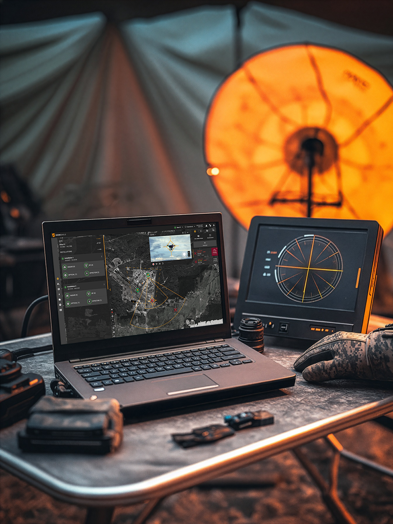
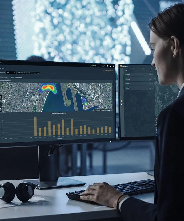
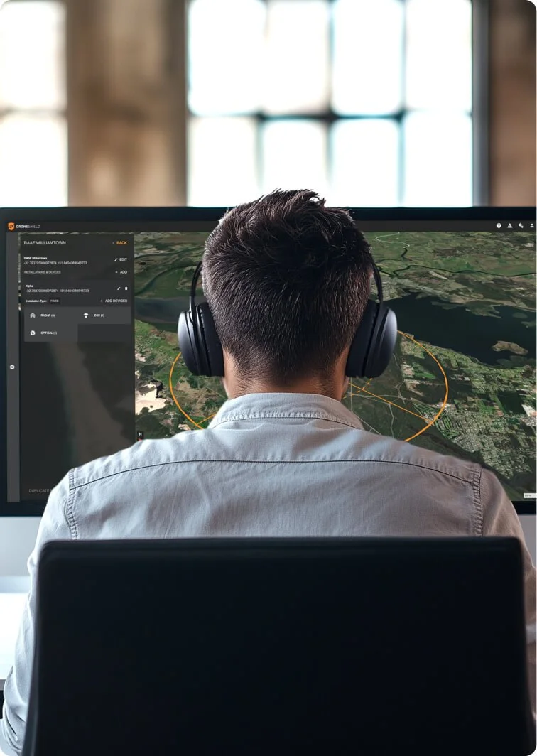
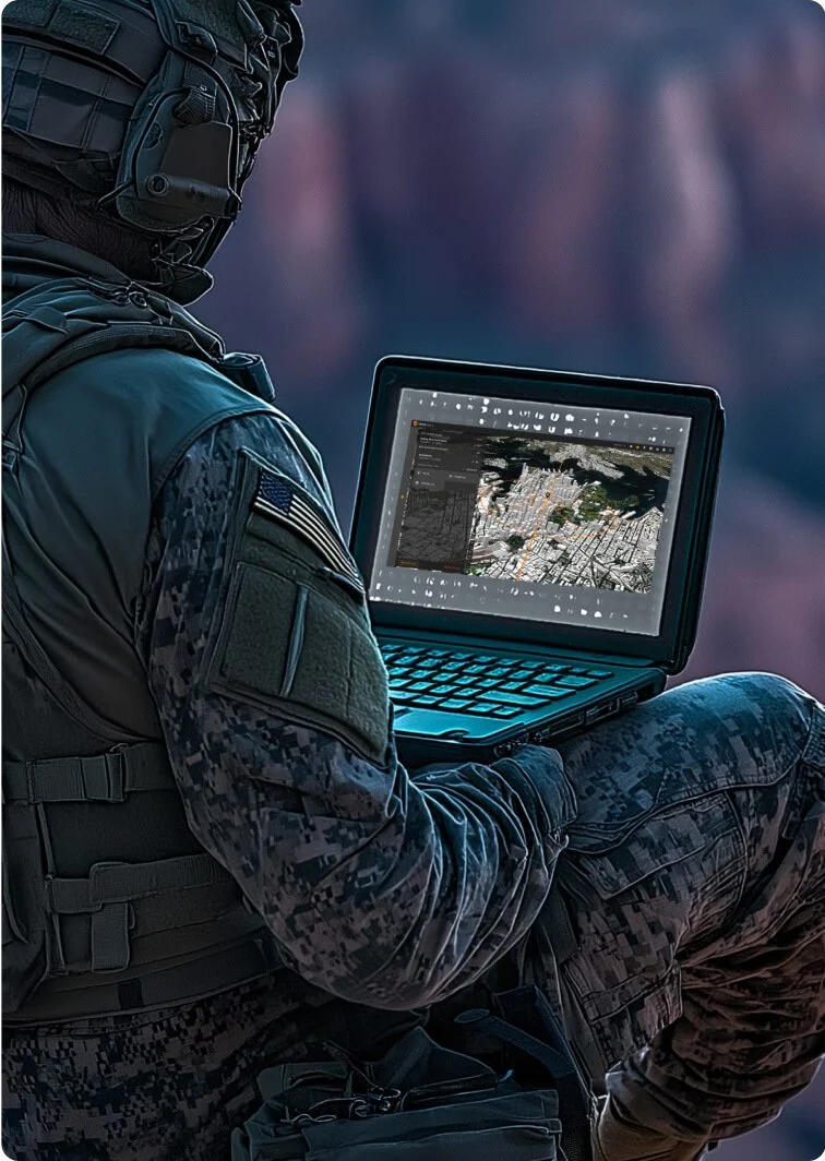
DroneSentry-C2
Command-and-Control Platform – On-Prem or Cloud Based
On-Premises Item Number: 407
Cloud Item Number: 408
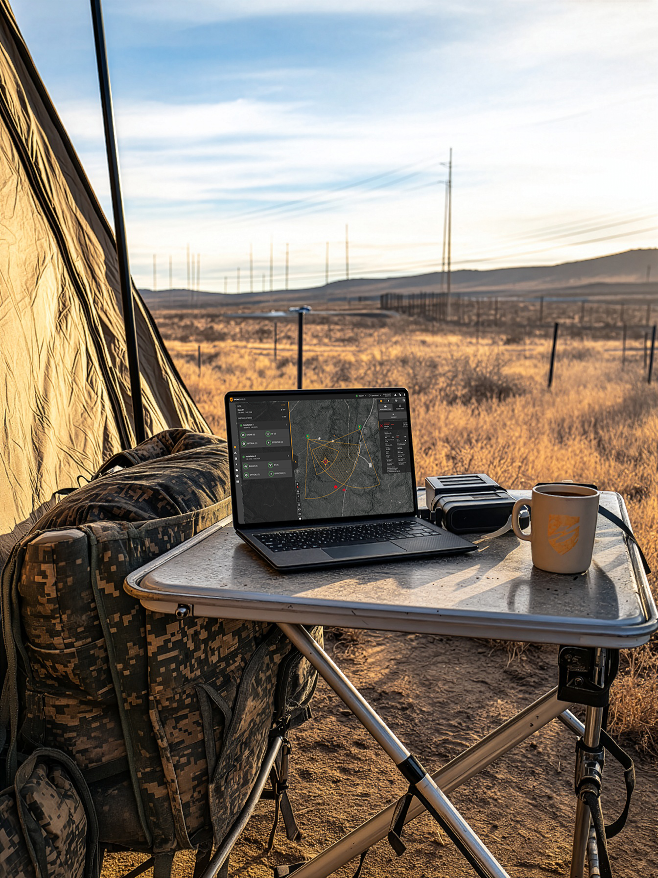
DroneSentry-C2 is an advanced command-and-control (C2) platform that delivers a unified, realtime counter-drone operating picture. Designed for seamless interoperability with DroneShield sensors and third-party systems, it enables precise detection, tracking, and response to drone threats. The system is available on secure cloud hosting or as a pre-provisioned on-premises server, offering flexible deployment to suit mission and infrastructure requirements.
Advantages

Scalable and Flexible
Designed for single or multi-site operations with secure cloud or on-premise deployment
Multi-Layered Detection
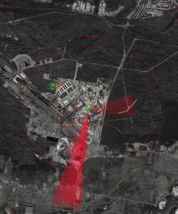
Combines RF sensing, radar, and optical sensors for comprehensive threat awareness
Deployment
Adaptable for military, law enforcement, and critical infrastructure protection
Features
Design
Centralized C2 platform with a modular and scalable architecture for enhanced operational control
Platform is built to scale horizontally and vertically, on-premise (air-gapped) or on cloud options are available
Interoperability
DroneSentry-C2 utilizes both DroneShield and third-party CUxS sensors and effectors. Those include multiple AI-enabled sensing and tracking products such as:
DroneSentry-X Mk2: RF sensors for UAS detection and optional defeat
VisionAI: camera-agnostic optical/thermal camera AI software
SensorFusionAI: sensor-agnostic, 3D data fusion engine
The GUI harnesses the advantages of each detection technology, providing the user with an early warning system and growing detection threat level as more data is gathered and processed
RESTful API allows easy deployment into existing security systems
Ease of Use
DroneSentry-C2 allows for remote access to DroneShield products to check statuses, configure system systems, monitor threat levels and respond in real-time
Detection statistics and logs are presented in clear summaries and can be exported for external use, providing vendor, location, duration, and MAC address details for comprehensive airspace activity insights
System Components
Digital Twin
Embedded Digital Twin planning tool allows for rapid planning of new site deployments to assess performance capabilities and ensure operational success in a visual real-world mirrored simulation. Existing sites can be saved and replicated into the platform to capture system deployment scenarios over its lifecycle.
VisionAI
Intuitive Controls
AI-powered automation and user-friendly interface streamline drone detection and classification
Live monitoring dashboard provides real-time drone activity monitoring, delivering vast amounts of environmental data in an intuitive format to support swift, informed decision making
Can be accessed and configured remotely from a web browser, wherever there is internet connectivity or as a standalone desktop application. Alerts are configured through the GUI to send via SMS or email for remote operators.
Optional Upgrades
DroneSentry-C2 has an optional Nearmap mapping upgrade for best-in-class mapping data. The upgrade supplements the existing mapping service provided with each DroneSentry-C2 license. Nearmap provides users with high resolution aerial imagery in Australia, New Zealand, and North America. Nearmap’s resolution is several times higher than standard satellite imagery, providing increased precision when responding to CUAS threats. Nearmap mapping data is regularly updated ensuring sites reflect the latest geospatial data for operators.
Versatility
Secure cloud-based processing allows operators to access their sites from anywhere, anytime
Onsite or ‘air-gapped’ hardware solutions are also available from the supplied on-premises server unit
Control and manage threats by engaging defeat capabilities
Specifications columns-2
On Premises
Increased Security
On-premises server allows for increased site security and control via an air-gapped network between sensors and processor.
Package Inclusions
DroneSentry-C2 Software License
Mapping Data
2RU Server
Quarterly Software Updates
Server Specifications
Processor: 2x Intel Xeon Silver 4510
RAM: 2x 16GB RDIMM, 5600MT/s
TAA compliant
Shipping and Installation
Dimensions: 87mm (H), 482mm (W), 772mm (D) / 3.4”, 19”, 30.4”
Weight: 36.1kg / 79.6lbs
Cloud-based
Increased Flexibility
Cloud hosting caters to flexible deployment scenarios where internet accessibility is readily available. Not requiring physical hardware means setup time and complexity is reduced.
Secure Site Management from Anywhere
Cloud-based processing allows operators to securely access their sites from anywhere, anytime.
Package Inclusions
DroneSentry-C2 Software License
Standard Mapping Data
Quarterly Software Updates
Compatibility columns-2-integrators-s
Sensor Interoperability
Bosch
Echodyne
Leonardo DRS
RADA
Teledyne FLIR
Sentrycs
ADS-B
Geospatial Interoperability
MAXAR
Maptiler
Bing
Google Maps
Esri
DroneSentry-C2 Enterprise
National-Scale Command, Simplified
On-Premises Item Number: 410
DroneSentry-C2 Enterprise is a scalable and flexible browser-based monitoring platform that enables users to view all connected DroneSentry-C2 sites for comprehensive and controlled oversight. Operators are able to effectively detect, verify, respond, and review with informed accuracy.
Advantages
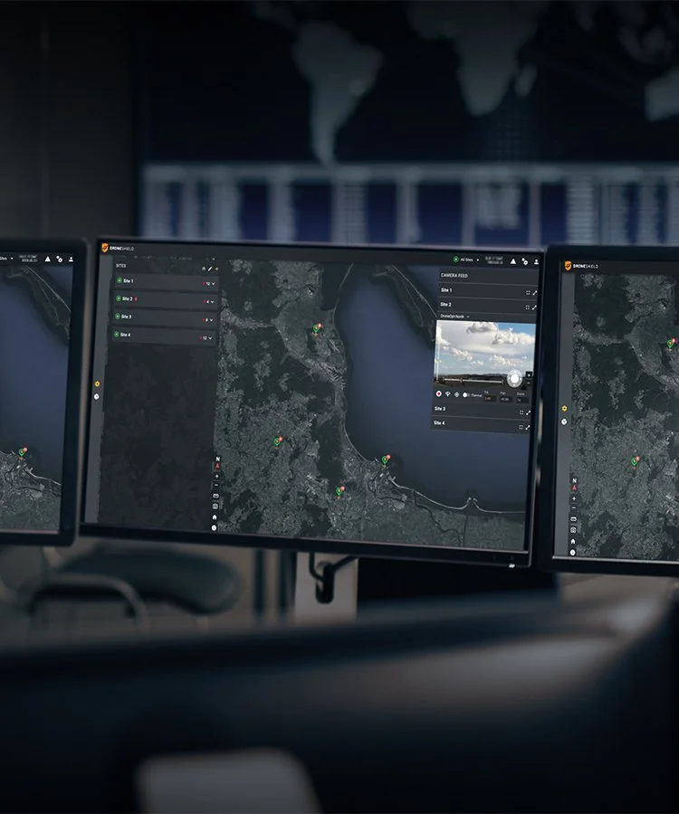
Multi-Site Visibility
Centralized oversight across all connected DroneSentry-C2 instances for unified and informed decision-making, including detailed after-action reporting via comprehensive analytics exporting
Scalable and Flexible
Designed to grow with national-level and multi-site deployments, from bases to airports and utilities
Faster, Smarter Response
Seamless transition between global visibility and site-level visibility to ensure a coordinated defense structure
Features
Enterprise Oversight
Monitor multiple DroneSentry-C2 systems with real-time user-defined sensor alerts from a single browser-based interface
Sensor Agnostic
Built with open architecture for compatibility with third-party systems and deployment into broader defense and security networks
Comprehensive Health Monitoring
Instant visibility into sensor and site readiness for continuous operational assurance
Threat Analysis
Site-level visibility allows users to view target threat information from DroneSentry-C2
Live Camera Feeds
Remote visual verification of threats to support rapid decision-making and enable enhanced situational awareness
Detailed Analytics
Ability to download comprehensive detection logs and data for further analysis, including exporting of site-specific information or all sites for full operational oversight
Compatibility gallery

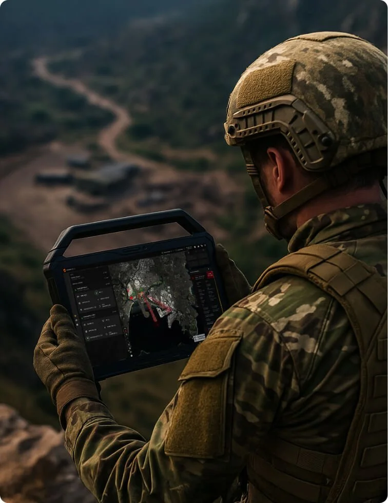
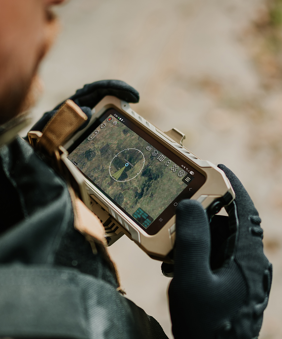
DroneSentry-C2 Tactical
Highly Rugged Command-and-Control Solution
Tablet Item Number: 121
Subscription Item Number: 121-1
DroneSentry-C2 Tactical (C2Tactical) is a portable, robust, on-the-edge version of DroneShield’s main Command-and-Control solution DroneSentry-C2. The system provides operators with real-time CUAS situational awareness in a compact form for mission-critical operations.
Advantages
Portable and Rapidly Deployable
Compact design enables fast setup and mobility in changing environments—ideal for tactical response or remote deployment

Intuitive Controls and Operation
AI-driven automation enables rapid threat detection and response with minimal operator training

Enhanced Situational Awareness
Provides true CUAS situational awareness, giving operators a decisive edge
Features
Design
Lightweight, portable system optimized for rapid deployment in all environments
All-in-one command-and-control platform, hosted and displayed on a rugged handheld device
Mission-Adaptable
The launch of the C2Tactical enables existing DroneShield end users to enhance their solutions as an “add-on” capability
Entry-level C2 solution for customers who do not require the full DroneSentry solution
Versatility
Can be used for single multi-sensor sites or several multi-sensor nodes working together
Air-Gapped solution for heightened security, advanced interoperability and enhanced flexibility for enterprise customers
Compatibility
Compatible with RfPatrol Mk2, DroneSentry-X and DroneSentry-X Mk2
RESTful API allows easy deployment into existing security systems
Operational Effectiveness
The C2Tactical provides an intuitive satellite map-based display with two-way communication between the user and the distributed network of counter-drone devices. Allows drone detections from a network of sensors back to a central point anywhere to a rugged user tablet, as well as the ability (where lawful) to activate drone defeat systems
Displays live UAS activity, providing alerts to the user about the environment, inbuilt tools for detailed, precise report generation
Ease of Use
Designed for easy transport and setup in minutes
AI-enhanced automation reduces the need for manual monitoring
Specifications columns-3-integrators-s
Tablet Specifications
Processor
Intel i7 (10 core) CPU
Memory
32GB RAM
Storage
1TB SSD
Operating System
Linux
Dimensions
203mm x 296mm x 23.9mm / 7.99" x 11.65" x 0.94"
Weight
1.26kg / 2.78lb - excluding accessories
Ports
2x USB-C / Thunderbolt
1x USB A
1x HDMI + Ethernet
Network Options
Wired Ethernet Connection
Wireless Link
Radio Mesh Network (Silvus Streamcaster, Persistent System MPU5)
4G Cellular Network (requires VPN)
Compliance
IP65 rated and conforms to MIL-STD-461 Emissions control
Software Specifications
Quarterly updates based on subscription
Supported Devices
RfPatrol Mk2
DroneSentry-X
DroneSentry-X Mk2
Shipping
Packaging:
Ships in a hard carry case
Package includes
Tablet, Charger, Removable Handle
RfLink
Drone Detection Awareness, Multiplied
DroneShield's RfLink is a mobile-first ATAK-CIV plugin offering rapid geospatial situational awareness in rural or civilian field environments. Ideal for agile teams with minimal hardware needs and users already operating within the TAK ecosystem. RfLink supports a 1:1 connection with the RfPatrol Mk2 and DroneSentry-X Mk2, allowing ATAK to consume and display detection alerts from connected devices and share with other end-user devices for advanced situational awareness.
Advantages

Alerts at a Glance
Real-time mapping and alerts provide enhanced situational awareness without additional hardware
Powered by ATAK-CIV
Designed for Android, enabling quick deployment and efficient field communication

Improved Coordination
Supports distributed teams with coordinated threat awareness for enhanced detection preparedness
Features
Seamless Interoperability
Built for users familiar with the ATAK platform for quick and easy adoption
Real-Time Geospatial Alerting
Delivers instant, map-based drone threat notifications
Detailed Detection Information
Comprehensive Detection Cards with identification controls to classify threats
Optimal for Agile Teams
Designed for use in fast-paced, rural, or civilian field environments
Universal Compatibility
Runs as a plugin on standard modern Android devices
Team Awareness
Multi-end user alert communications allow for streamlined and efficient mission deployment
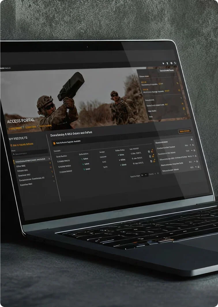
Access Portal
Centralized Access to Mission-Critical Support and Resources
DroneShield’s Access Portal provides secure, streamlined access to support tools, key resources, and product sustainment insights—built to support teams and enhance readiness at every stage.
Advantages
Mission-Ready
Streamlined access to planning tools, documentation, and updates ensures operators are equipped for every mission scenario-before, during, and after deployment
Accelerated Decision-Making
Advanced 3D planning tool and interactive UAS incident database provide insights to support rapid, informed operational decisions
Lifecycle Support, Simplified
Resources such as training, manuals, inventory and equipment management, hardware warranties, software subscriptions, firmware, technical support, in one centralized location
Features
3D Mission Planning Tool
Enables mission planning with real-world terrain, line-of-sight analysis, and sensor coverage modeling
Integrates environmental and threat data to optimize placement and coverage of deployed systems
Firmware Updates and Version Control
Secure delivery of firmware packages with update history and system compatibility notes
Ensures systems operate with the latest performance enhancements and security patches
Secure, Role-Based Access Controls
Multi-level user permissions to ensure data security and operational integrity
Audit trail capabilities for accountability and compliance tracking
Global UAS Incident Database
Provides searchable, interactive map of global drone incidents with filters by region, type, and severity
Delivers situational awareness and intelligence to inform system deployment and threat response
Direct Technical Support Contacts
Priority access to technical experts for troubleshooting and operational questions
Case tracking and response documentation to support continuity and resolution
Product and Training Manuals
Includes full documentation for setup, operation, and maintenance of products
Updated regularly to reflect latest software versions and hardware configurations
System Usage Logs and Performance Insights
Tracks system health, usage patterns, and diagnostics to inform sustainment decisions
Enables predictive maintenance planning and operational optimization
Solutions Support
Full customer tech support, access to training portal, and option to purchase training packages
Training
Tailored Training Solutions
Expert training packages are customized to meet the unique needs of each team, ensuring maximum impact and efficiency.Comprehensive Curriculum
We offer a wide range of in-depth training modules, covering everything from basic to advanced topics, ensuring DroneShield users gain the skills they need to succeed.Hands-On Learning Experience
Our interactive, practical training approach helps participants apply new skills immediately, reinforcing learning through real-world scenarios.Flexible Delivery Options
Options include on-site instruction or live virtual sessions, tailored to fit varying schedules and learning preferences.Support and ResourcesContinued access to training materials, tutorials, and follow-up support through our customer portal ensures our users are proficient on the use of our systems.
Technical Support
On-Demand Help
A team of expert tech support specialists is readily available to provide fast, reliable assistance for any technical challenges.Highly Trained Support Staff
Our support team consists of certified specialists with extensive knowledge of our products, ensuring quick and accurate resolutions.Comprehensive Troubleshooting
Whether it’s a simple question or a complex issue, we provide detailed, step-by-step guidance to resolve any problem.Remote Assistance & Onsite Support
Both remote troubleshooting and on-site support options are available to provide maximum flexibility in addressing technical needs.Customer-Centric Solutions
Expert tech support focuses on delivering tailored solutions that align with specific requirements, ensuring satisfaction and continued success with the products.